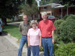
National Weather Service staff searching for high-water markers

CAMBRIDGE -- Several members of the National Weather Service were recently in the area searching for the "high water marks" made in 1936 by Cambridge monument maker, D. F. Neiswanger.
The monuments were made to indicate the highest water level from the 1935 Republican River Flood. Mr. Neiswanger was quoted in 1936, "In future years people would probably guess, wonder and argue as to the highest point the water reached, and these markers would settle all arguments ... and remove any doubts from anyone's mind."
The Goodland office of the National Weather Service is working on a historical weather project for 2010 -- the 75th anniversary of the 1935 Republican River Flood. As part of this project, they want to give Mr. Neiswanger credit for the work he did and in the future install signage for the high water mark monuments. Joy Hayden of the National Weather Service says, "He (Neiswanger) had great foresight in marking these locations."

The booklet, "High Water Mark," a collection of photographs and stories about the great Republican River Flood of May 31-June 1, 1935, compiled by Raymond Borchers stated that Mr. Neiswanger began a campaign in early 1936 to permanently establish memorials to the flood by placing small stone markers at the high water line. Only six of the eight markers placed by Neiswanger have been found. Whether there are others is uncertain.
As stated in the March 12, 1936, issue of the Cambridge Clarion, "These markers made by Mr. Neiswanger are of the best of granite and the size is 8x8x14 with a polished top and the inscription cut in raised letters reads as follows: "High water mark 5-31-35. There are other communities in the valley that could use these markers and Mr. Neiswanger would be glad to deliver them at a cost of only eight dollars."
The most westerly marker (as records indicate) is located north of Haigler across the railroad tracks to the river bridge. The marker is 200 yards south on the east side. The second marker is south of Trenton at the "T" in the road and then south 100 feet. The third marker in Bartley is at the northwest intersection of Commercial and Cedar. There are two markers in Cambridge -- at the northwest corner of Pacific and Nelson and just south of the intersection of Highways 6-34 and 47. The sixth marker is located in Edison's City Park mounted on a pedestal three feet high.
Linda Hein, Reference Assistant with the Nebraska State Historical Society has assisted The National Weather Service in its search. If anyone knows the location of the other two "High Water Marks," please contact Joy at the National Weather Service, Goodland office at (800) 272-7811.
Footnote from Oxford Rotary Club, Historical Land Mark Council: On May 30, 1935, torrential rains fell in eastern Colorado and southwestern Nebraska; by early morning of the 31st, the usually peaceful Republican River was running bluff-to-bluff along its upper reaches. When the waters subsided two days later, over 100 lives had been lost and many millions of dollars of damage had been done.
After the prolonged drought of the early 1930s, the wet spring of 1935 had brought welcome relief to the region. By the end of May, however, the soil was nearing the saturation point. The rains of May 30 concentrated in the basin of the South Fork and extending into the valleys of the Arikaree, Frenchman, Red Willow, and Medicine, poured into the main stream -- normally 300 to 400 feet wide, turning it into a raging torrent one to four miles wide.
The flood water came as a wall, variously estimated at from three to eight feet in height. The advance of the crest was more rapid in the upper valley, reported at 10 mph above Trenton, at five between there and Oxford, and slowing to 2 1/2 mph upon crossing over into Kansas.
To prevent the repetition of such a tragedy the federal government has built a series of six dams, five in Nebraska, across the Republican or its tributaries, serving not only as flood protection, but providing recreation and irrigation facilities as well.
